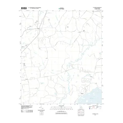
2011 Map of Calvary
USGS Topo · Published 2011About this map
The Ochlockonee River meanders across this borderlands landscape, defining the transition between the Georgia and Florida countryside. This survey captures a rural network of family-held land and community burial grounds, such as Gainey Cemetery and Williams Cemetery, which anchor the small settlements of Calvary and Pine Hill. The southern portion of the map is dominated by the northern reaches of Lake Iamonia and the Meridian community, where the terrain softens into the lake basin.
Find a feature on this map
62 named features on this map. Tap any name to fly to it.
Don’t see what you’re looking for? This feature index may not catch every label — zoom into the map to look around manually.
Map Details
Editions of this 2011 Calvary Map
This is the sole edition of this map. No revisions or reprints were ever made.
Other maps of this area

1954 · Tallahassee
USGS Topo · 1:250,000

1955 · Whigham
USGS Topo · 1:62,500

1956 · Havana North
USGS Topo · 1:24,000

1956 · Cairo
USGS Topo · 1:62,500

1956 · Calvary
USGS Topo · 1:24,000

1957 · Beachton
USGS Topo · 1:24,000

1959 · Tallahassee
USGS Topo · 1:250,000

1960 · Tallahassee
USGS Topo · 1:250,000
1963 · Bradfordville
USGS Topo · 1:24,000

1963 · Lake Jackson
USGS Topo · 1:24,000