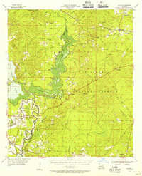
1955 Map of Calvin
USGS Topo · Published 1956About this map
The Kisatchie National Forest dominates this mid-century landscape where the border of Natchitoches Parish and Winn Parish meets. Centered on the settlement of Calvin, the area is defined by a dense network of watercourses and bayous, notably the Saline Bayou and Black Lake Bayou, which drain into Clear Lake and Cheechee Bay. These waterways, once vital for local industry and transport, are punctuated by structures like Allen Dam and Chivery Dam.
Find a feature on this map
66 named features on this map. Tap any name to fly to it.
Don’t see what you’re looking for? This feature index may not catch every label — zoom into the map to look around manually.
Map Details
Editions of this 1955 Calvin Map
3 editions found
Other maps of this area

1932 · Colfax NW
USGS Topo · 1:31,680

1935 · Verda
USGS Topo · 1:31,680

1936 · Colfax
USGS Topo · 1:62,500

1937 · Campti NE
USGS Topo · 1:31,680

1937 · Bermuda
USGS Topo · 1:31,680

1937 · Campti SE
USGS Topo · 1:31,680

1937 · Montgomery
USGS Topo · 1:62,500

1942 · Montgomery
USGS Topo · 1:62,500

1943 · Provencal
USGS Topo · 1:62,500

1944 · Campti
USGS Topo · 1:62,500