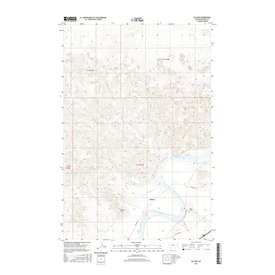
2017 Map of Calypso
USGS Topo · Published 2017About this map
The Yellowstone River anchors this central Prairie County landscape, carving a wide path through the Montana badlands. Near the river's bend, the small community of Calypso sits at the base of significant elevation changes, shadowed by the prominent Sheridan Butte to the west. The river itself features the Wolf Rapids, a notable navigational point for local water travel and geography.
Find a feature on this map
20 named features on this map. Tap any name to fly to it.
Don’t see what you’re looking for? This feature index may not catch every label — zoom into the map to look around manually.
Map Details
Editions of this 2017 Calypso Map
This is the sole edition of this map. No revisions or reprints were ever made.
Other maps of this area

1953 · Miles City
USGS Topo · 1:250,000

1957 · Miles City
USGS Topo · 1:250,000

1958 · Miles City
USGS Topo · 1:250,000

1969 · Zero NE
USGS Topo · 1:24,000

1969 · Zero
USGS Topo · 1:24,000

1969 · Kinsey NE
USGS Topo · 1:24,000

1972 · Calypso
USGS Topo · 1:24,000

1972 · Papps Reservoir
USGS Topo · 1:24,000

1972 · Mc Clure Reservoir
USGS Topo · 1:24,000

1972 · Diamond G Creek
USGS Topo · 1:24,000