
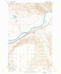
1972 Map of Diamond G Creek
USGS Topo · Published 1975About this map
The boundary between Prairie County and Dawson County cuts through this high-plains landscape, characterized by a complex network of seasonal drainage and water-resource development. During the early 1970s, the terrain was defined by the deep incisions of McQuoid Coulee and Diekhoff Coulee, which channel runoff toward more significant creek systems. The presence of numerous wells, a drill hole, and specifically named features like Spade Well suggest a focus on livestock watering and perhaps early exploration in this arid stretch of eastern Montana. Larger watercourses including Diamond G Creek, Cottonwood Creek, and Brackett Creek anchor the topography, while a Gravel Pit near the northern boundary indicates the localized extraction of materials for ranch roads or regional infrastructure.
Find a feature on this map
15 named features on this map. Tap any name to fly to it.
Don’t see what you’re looking for? This feature index may not catch every label — zoom into the map to look around manually.
Map Details
Editions of this 1972 Diamond G Creek Map
This is the sole edition of this map. No revisions or reprints were ever made.
Other maps of this area

1953 · Miles City
USGS Topo · 1:250,000

1954 · Glendive
USGS Topo · 1:250,000

1957 · Miles City
USGS Topo · 1:250,000

1957 · Glendive
USGS Topo · 1:250,000

1958 · Miles City
USGS Topo · 1:250,000

1958 · Glendive
USGS Topo · 1:250,000

1972 · Hendrickson Coulee
USGS Topo · 1:24,000

1972 · Calypso
USGS Topo · 1:24,000

1972 · Papps Reservoir
USGS Topo · 1:24,000
1972 · Fallon SW
USGS Topo · 1:24,000