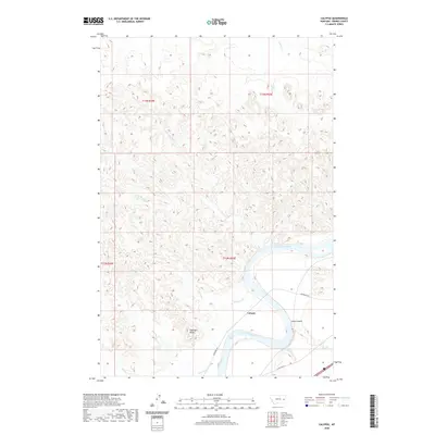
2020 Map of Calypso
USGS Topo · Published 2020About this map
The Yellowstone River carves a deep arc through this section of Prairie County, Montana, defining the local geography and transportation corridors. Along its southern bank, the settlement of Calypso sits near the bend where the Milwaukee Rd and W Old Hwy 10 parallel the water. The landscape is marked by a complex network of drainages including Sullivan Cr, Lost Boy Cr, and Cherry Cr, which feed into the main river valley. Notable terrain features like Sheridan Butte rise above the surrounding coulees and creeks, while Wolf Rapids indicates the river's dynamic character in this reach. The presence of Calypso Spring suggests the importance of water sources in this arid environment, where land is still organized by the Public Land Survey System townships like t12n r50e.
Find a feature on this map
20 named features on this map. Tap any name to fly to it.
Don’t see what you’re looking for? This feature index may not catch every label — zoom into the map to look around manually.
Map Details
Editions of this 2020 Calypso Map
This is the sole edition of this map. No revisions or reprints were ever made.
Other maps of this area

1953 · Miles City
USGS Topo · 1:250,000

1957 · Miles City
USGS Topo · 1:250,000

1958 · Miles City
USGS Topo · 1:250,000

1969 · Zero NE
USGS Topo · 1:24,000

1969 · Zero
USGS Topo · 1:24,000

1969 · Kinsey NE
USGS Topo · 1:24,000

1972 · Calypso
USGS Topo · 1:24,000

1972 · Papps Reservoir
USGS Topo · 1:24,000

1972 · Mc Clure Reservoir
USGS Topo · 1:24,000

1972 · Diamond G Creek
USGS Topo · 1:24,000