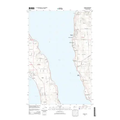
2014 Map of Camano
USGS Topo · Published 2014About this map
Saratoga Passage defines the central corridor of this coastal study, separating the eastern shore of Whidbey Island from the rugged bluffs of Camano Island. The landscape is a mosaic of shoreline developments and rural prairie land, with concentrated settlements like Madrona Beach, Sunset Beach, and Rockaway Beach clinging to the western edge of Camano. Inland, Smith Prairie occupies a significant portion of the Whidbey side, bordered by unique coastal features such as Harrington Lagoon and Race Lagoon. The map provides a detailed look at the island's 21st-century infrastructure, including the network of residential roads like Keystone Ave and W Morris Rd that service both seasonal retreats and permanent communities. To the south, North Bluff stands as a prominent topographical feature overlooking the waters of Admiralty Inlet, while smaller water bodies like Carp Lake and Dry Lake dot the island interior.
Find a feature on this map
112 named features on this map. Tap any name to fly to it.
Don’t see what you’re looking for? This feature index may not catch every label — zoom into the map to look around manually.
Map Details
Editions of this 2014 Camano Map
This is the sole edition of this map. No revisions or reprints were ever made.
Other maps of this area

1911 · Mount Vernon
USGS Topo · 1:125,000

1939 · Coupeville
USGS Topo · 1:62,500

1940 · Mt Vernon
USGS Topo · 1:62,500

1943 · Mt Vernon
USGS Topo · 1:62,500

1943 · Stanwood
USGS Topo · 1:62,500

1943 · Deception Pass
USGS Topo · 1:62,500

1951 · Deception Pass
USGS Topo · 1:62,500

1953 · Coupeville
USGS Topo · 1:24,000

1953 · Freeland
USGS Topo · 1:24,000

1953 · Nordland
USGS Topo · 1:24,000