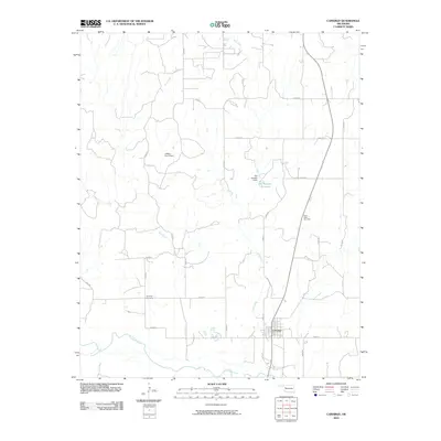
2010 Map of Camargo
USGS Topo · Published 2010About this map
The town of Camargo serves as the central hub of this Dewey County landscape, situated along a bend of the Canadian River. This 2010 USGS survey illustrates a rural Oklahoma terrain defined by a network of sectional roads and water management features. Genealogists and local historians will find the locations of Camargo Cemetery and Cedar Valley Cemetery essential for tracing family roots in the area. The hydrology of the region is dominated by several drainage systems, including Trail Creek and Gyp Creek, which feed into the main river channel. Artificial water features such as the Day Number 1 Reservoir, held by the Day Number 1 Dam, and the Jeffrey Ecd 4 Dam indicate the local reliance on water storage for agricultural or municipal needs in this prairie environment. The map provides a detailed view of the infrastructure just before the second decade of the 21st century.
Find a feature on this map
25 named features on this map. Tap any name to fly to it.
Don’t see what you’re looking for? This feature index may not catch every label — zoom into the map to look around manually.
Map Details
Editions of this 2010 Camargo Map
This is the sole edition of this map. No revisions or reprints were ever made.
Other maps of this area

1955 · Clinton
USGS Topo · 1:250,000

1955 · Woodward
USGS Topo · 1:250,000

1957 · Clinton
USGS Topo · 1:250,000

1958 · Woodward
USGS Topo · 1:250,000

1961 · Leedey
USGS Topo · 1:62,500

1962 · Aledo
USGS Topo · 1:62,500

1969 · Vici NW
USGS Topo · 1:24,000

1969 · Mutual SW
USGS Topo · 1:24,000

1969 · Mutual
USGS Topo · 1:24,000

1969 · Camargo
USGS Topo · 1:24,000