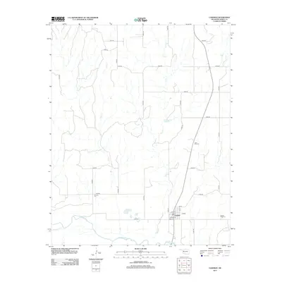
2012 Map of Camargo
USGS Topo · Published 2012About this map
Camargo sits as the central settlement in this Dewey County landscape, defined by the winding course of the Canadian River and its northern tributaries. The town layout is clearly visible, with streets such as Main St, W Main, and Boatman St forming the community core. This 2012 snapshot of western Oklahoma shows a rural environment where land use is marked by several local burial grounds and water management features. Genealogists and local historians can locate Camargo Cem, Cedar Valley Cem, and the Brooker Meek Cem, which serve as significant markers of the area's family history. The drainage network, including Gyp Cr, Trail Cr, and Powwow Cr, shapes the topography, while the Day Number 1 Reservoir indicates local water storage efforts in this semi-arid region.
Find a feature on this map
31 named features on this map. Tap any name to fly to it.
Don’t see what you’re looking for? This feature index may not catch every label — zoom into the map to look around manually.
Map Details
Editions of this 2012 Camargo Map
This is the sole edition of this map. No revisions or reprints were ever made.
Other maps of this area

1955 · Clinton
USGS Topo · 1:250,000

1955 · Woodward
USGS Topo · 1:250,000

1957 · Clinton
USGS Topo · 1:250,000

1958 · Woodward
USGS Topo · 1:250,000

1961 · Leedey
USGS Topo · 1:62,500

1962 · Aledo
USGS Topo · 1:62,500

1969 · Vici NW
USGS Topo · 1:24,000

1969 · Mutual SW
USGS Topo · 1:24,000

1969 · Mutual
USGS Topo · 1:24,000

1969 · Camargo
USGS Topo · 1:24,000