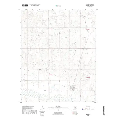
2018 Map of Camargo
USGS Topo · Published 2018About this map
Camargo serves as the primary hub in this Dewey County landscape, situated just north of the Canadian River. The town's grid is centered around Main St and Broadway St, with local streets such as Black St and Boatman St defining its core. The surrounding terrain is heavily influenced by the drainage patterns of Trail Cr and Gyp Cr, which carve through the plains toward the river valley to the south. Genealogists will find three distinct burial sites on this sheet: Camargo Cem west of town, Cedar Valley Cem to the north, and Brooker-Meek Cem to the southeast. The inclusion of the Day Number 1 Reservoir highlights the importance of water management in this agricultural region of western Oklahoma.
Find a feature on this map
34 named features on this map. Tap any name to fly to it.
Don’t see what you’re looking for? This feature index may not catch every label — zoom into the map to look around manually.
Map Details
Editions of this 2018 Camargo Map
This is the sole edition of this map. No revisions or reprints were ever made.
Other maps of this area

1955 · Clinton
USGS Topo · 1:250,000

1955 · Woodward
USGS Topo · 1:250,000

1957 · Clinton
USGS Topo · 1:250,000

1958 · Woodward
USGS Topo · 1:250,000

1961 · Leedey
USGS Topo · 1:62,500

1962 · Aledo
USGS Topo · 1:62,500

1969 · Vici NW
USGS Topo · 1:24,000

1969 · Mutual SW
USGS Topo · 1:24,000

1969 · Mutual
USGS Topo · 1:24,000

1969 · Camargo
USGS Topo · 1:24,000