
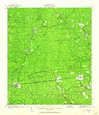
1917 Map of Cambon
USGS Topo · Published 1960About this map
The rail junctions of Baldwin and surrounding timberlands define this 1917 topographic study of the Florida interior. Strategically positioned where the Seaboard Air Line intersects the Atlantic Coast Line, Baldwin serves as a vital transit point for the region's early 20th-century economy. The landscape is a network of wet prairies and timber stands, marked by Brandy Branch Swamp and the headwaters of the Trout River.
Find a feature on this map
47 named features on this map. Tap any name to fly to it.
Don’t see what you’re looking for? This feature index may not catch every label — zoom into the map to look around manually.
Map Details
Editions of this 1917 Cambon Map
2 editions found
Other maps of this area

1917 · Orange Park
USGS Topo · 1:62,500

1917 · Macclenny
USGS Topo · 1:62,500

1917 · Hilliard
USGS Topo · 1:62,500

1918 · St Marys
USGS Topo · 1:62,500

1918 · Middleburg
USGS Topo · 1:62,500

1918 · Moniac
USGS Topo · 1:62,500

1918 · Lawtey
USGS Topo · 1:62,500

1918 · Cambon
USGS Topo · 1:62,500

1918 · Jacksonville
USGS Topo · 1:62,500

1918 · Orange Park
USGS Topo · 1:62,500