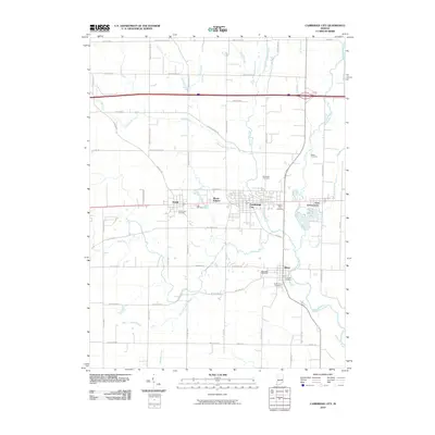
2010 Map of Cambridge City
USGS Topo · Published 2010About this map
Cambridge City and its neighboring towns of Dublin, Mount Auburn, East Germantown, and Milton occupy this corridor along the Whitewater River. This portion of Indiana is characterized by a dense concentration of local burial grounds, including the Friends Cemetery, Capitol Hill Cemetery, Riverside Cemetery, and South Lawn Cemetery, which offer significant value for genealogical research. The landscape is defined by the winding paths of Martindale Creek, Symonds Creek, and Lick Branch, with the smaller We-Hi Lake providing a focal point near East Germantown. The mapping of many rural thoroughfares like Goose Heaven RD, Brick Church RD, and Treaty Line RD illustrates the enduring grid of the regional transportation network and its relationship to the surrounding creek systems.
Find a feature on this map
73 named features on this map. Tap any name to fly to it.
Don’t see what you’re looking for? This feature index may not catch every label — zoom into the map to look around manually.
Map Details
Editions of this 2010 Cambridge City Map
This is the sole edition of this map. No revisions or reprints were ever made.
Other maps of this area

1948 · Lewisville
USGS Topo · 1:24,000

1950 · New Castle East
USGS Topo · 1:24,000

1950 · Lewisville
USGS Topo · 1:24,000

1953 · Cincinnati
USGS Topo · 1:250,000

1956 · Brownsville
USGS Topo · 1:24,000

1956 · Connersville
USGS Topo · 1:24,000

1957 · Cincinnati
USGS Topo · 1:250,000

1959 · Falmouth
USGS Topo · 1:24,000

1960 · New Castle East
USGS Topo · 1:24,000
1960 · Hagerstown
USGS Topo · 1:24,000