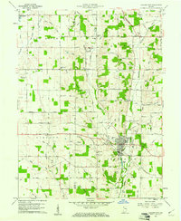
1960 Map of Hagerstown
USGS Topo · Published 1961About this map
Hagerstown anchors the intersection of several key natural and man-made corridors as they appeared at the start of the 1960s. The Whitewater River and its tributary, Nettle Creek, provide the primary drainage for this agricultural region, while the Pennsylvania Railroad and Hagerstown Airport represent the transportation infrastructure of the mid-century era. A notable cultural landmark is the Wilbur Wright Memorial in the northwest, honoring the aviation pioneer's local birthplace.
Find a feature on this map
83 named features on this map. Tap any name to fly to it.
Don’t see what you’re looking for? This feature index may not catch every label — zoom into the map to look around manually.
Map Details
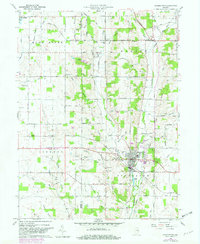
Editions of this 1960 Hagerstown Map
2 editions found
Other maps of this area

1948 · Lewisville
USGS Topo · 1:24,000

1950 · New Castle East
USGS Topo · 1:24,000

1950 · Lewisville
USGS Topo · 1:24,000

1953 · Cincinnati
USGS Topo · 1:250,000

1953 · Muncie
USGS Topo · 1:250,000

1956 · Muncie
USGS Topo · 1:250,000

1957 · Cincinnati
USGS Topo · 1:250,000

1960 · New Castle East
USGS Topo · 1:24,000

1960 · Mount Pleasant
USGS Topo · 1:24,000

1960 · Carlos
USGS Topo · 1:24,000