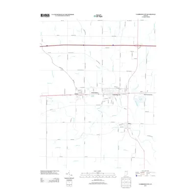
2013 Map of Cambridge City
USGS Topo · Published 2013About this map
Cambridge City and its neighboring villages sit along the historic National Road corridor in western Wayne County, illustrating a dense pattern of settlement characteristic of east-central Indiana. The town of Dublin and the smaller community of Mount Auburn appear to the west, while the village of Milton is situated to the south along the Whitewater River. This waterway and its numerous tributaries, such as Symonds Cr and Martindale Cr, define the drainage of the area. The map reveals the transition of the landscape into an organized grid of rural routes including Goose Heaven Rd and Frank Myers Rd. Local landmarks like Hi-Way Springs and We-Hi Lake provide specific points of interest for those studying the social and natural geography of the region. Significant drainage features like the Davis Rich Ditch and Milton Drain underscore the importance of water management in this agricultural and small-town landscape.
Find a feature on this map
125 named features on this map. Tap any name to fly to it.
Don’t see what you’re looking for? This feature index may not catch every label — zoom into the map to look around manually.
Map Details
Editions of this 2013 Cambridge City Map
This is the sole edition of this map. No revisions or reprints were ever made.
Other maps of this area

1948 · Lewisville
USGS Topo · 1:24,000

1950 · New Castle East
USGS Topo · 1:24,000

1950 · Lewisville
USGS Topo · 1:24,000

1953 · Cincinnati
USGS Topo · 1:250,000

1956 · Brownsville
USGS Topo · 1:24,000

1956 · Connersville
USGS Topo · 1:24,000

1957 · Cincinnati
USGS Topo · 1:250,000

1959 · Falmouth
USGS Topo · 1:24,000

1960 · New Castle East
USGS Topo · 1:24,000
1960 · Hagerstown
USGS Topo · 1:24,000