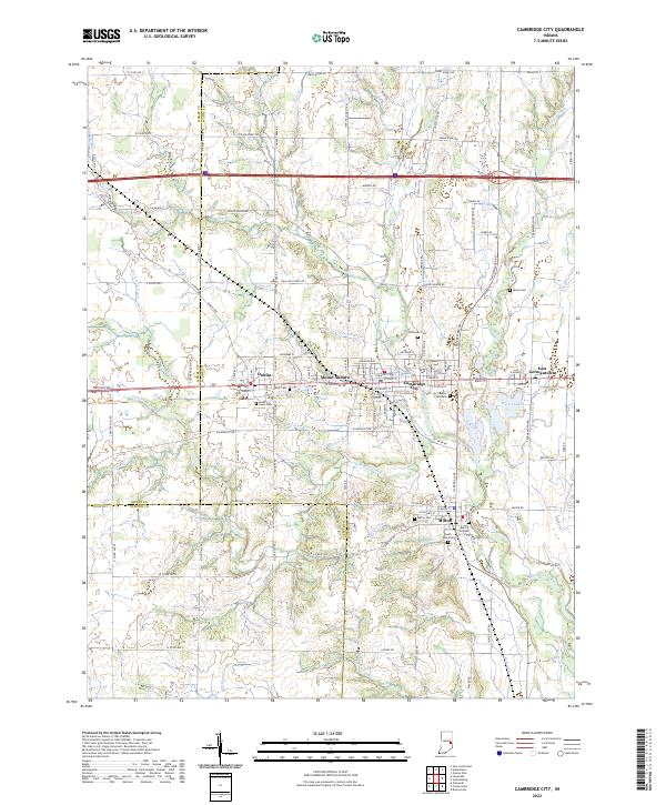
2022 Map of Cambridge City
USGS Topo · Published 2022About this map
Cambridge City and Milton anchor the Whitewater Valley in this detailed modern survey of Wayne and Fayette Counties. The Whitewater River cuts through the center of the terrain, while its tributaries like Martindale Creek and Symons Creek define the surrounding landscape. This area is a cluster of established settlements, including Dublin, Mount Auburn, and East Germantown, many of which follow the path of W National Rd. Genealogical researchers will find several significant burial sites, such as the Milford Friends Cem near Milton and Capitol Hill Cem in Cambridge City. The presence of the Nickle Plate Rd and landmarks like Hi-Way Springs highlight the intersection of mid-century transport infrastructure and natural geography that shaped these Eastern Indiana communities.
Find a feature on this map
95 named features on this map. Tap any name to fly to it.
Don’t see what you’re looking for? This feature index may not catch every label — zoom into the map to look around manually.
Map Details
Editions of this 2022 Cambridge City Map
This is the sole edition of this map. No revisions or reprints were ever made.
Other maps of this area

1948 · Lewisville
USGS Topo · 1:24,000

1950 · New Castle East
USGS Topo · 1:24,000

1950 · Lewisville
USGS Topo · 1:24,000

1953 · Cincinnati
USGS Topo · 1:250,000

1956 · Brownsville
USGS Topo · 1:24,000

1956 · Connersville
USGS Topo · 1:24,000

1957 · Cincinnati
USGS Topo · 1:250,000

1959 · Falmouth
USGS Topo · 1:24,000

1960 · New Castle East
USGS Topo · 1:24,000
1960 · Hagerstown
USGS Topo · 1:24,000