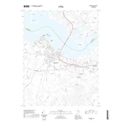
2019 Map of Cambridge
USGS Topo · Published 2019About this map
Cambridge sits at the heart of this coastal survey, where the massive Senator Malkus Jr Brg carries the Ocean Gateway across the Choptank River. The city's layout is well-defined by numerous local landmarks and burial grounds, including Cambridge Cem, Waugh Cem, and Christ Cem, which provide significant data points for genealogists and local historians. To the west, the community of Algonquin borders Hambrooks Bay, while smaller settlements like Jacktown and Christs Rock appear further inland.
Find a feature on this map
151 named features on this map. Tap any name to fly to it.
Don’t see what you’re looking for? This feature index may not catch every label — zoom into the map to look around manually.
Map Details
Editions of this 2019 Cambridge Map
This is the sole edition of this map. No revisions or reprints were ever made.
Other maps of this area

1898 · Choptank
USGS Topo · 1:125,000

1898 · St. Marys
USGS Topo · 1:125,000

1903 · Nanticoke
USGS Topo · 1:62,500

1904 · Oxford
USGS Topo · 1:62,500

1905 · Crapo
USGS Topo · 1:62,500

1905 · Hurlock
USGS Topo · 1:62,500

1906 · St. Marys
USGS Topo · 1:125,000

1908 · Choptank
USGS Topo · 1:125,000

1942 · Oxford
USGS Topo · 1:31,680

1942 · Church Creek
USGS Topo · 1:24,000