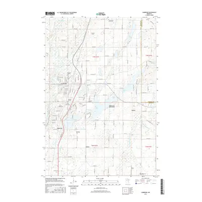
2016 Map of Cambridge
USGS Topo · Published 2016About this map
Cambridge serves as the focal point of this 2016 survey, situated along the winding Rum River and the BNSF Railway corridor. The landscape is characterized by its high density of historical cemeteries, such as the Cambridge Lutheran Cem and Grandy Swedish Adventist Cem, which reflect the area's deep-rooted denominational heritage. The mapping reveals a complex network of water bodies, including Lake Fannie, Skogman Lake, and Elms Lake, intertwined with man-made drainage systems like Judicial Ditch Number Four. Distinctive landmarks such as Minnesota Boys Town and the Troll Farm Airport highlight the mix of community institutions and local aviation facilities present in this Isanti County region. The presence of numerous gravel pits and the Garden of Remembrance further illustrate the ongoing human modification of the glacial terrain south of Grandy Swedish Adventist Cem.
Find a feature on this map
96 named features on this map. Tap any name to fly to it.
Don’t see what you’re looking for? This feature index may not catch every label — zoom into the map to look around manually.
Map Details
Editions of this 2016 Cambridge Map
This is the sole edition of this map. No revisions or reprints were ever made.
Other maps of this area

1916 · St. Francis
USGS Topo · 1:62,500

1919 · St. Francis
USGS Topo · 1:62,500

1953 · Stillwater
USGS Topo · 1:250,000

1955 · Isanti
USGS Topo · 1:62,500

1955 · Stillwater
USGS Topo · 1:250,000

1958 · Stillwater
USGS Topo · 1:250,000

1961 · Bradford
USGS Topo · 1:24,000

1961 · Cambridge
USGS Topo · 1:62,500

1961 · Springvale
USGS Topo · 1:24,000

1961 · Dalbo
USGS Topo · 1:62,500