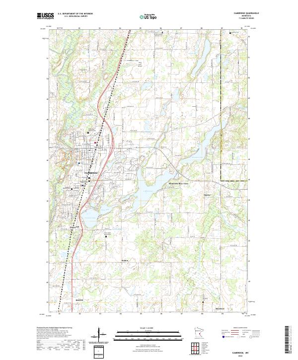
2022 Map of Cambridge
USGS Topo · Published 2022About this map
The Rum River winds through the western portion of this Isanti County landscape, anchoring the city of Cambridge and the southern town of Isanti. This 2022 survey details a region defined by its numerous glacial lakes and intricate drainage systems, including Lake Fannie, Skogman Lake, and Florence Lake. The mapping of Judicial Ditch Number Four and County Ditch Number Nineteen illustrates the long-standing agricultural management of the surrounding wetlands.
Find a feature on this map
47 named features on this map. Tap any name to fly to it.
Don’t see what you’re looking for? This feature index may not catch every label — zoom into the map to look around manually.
Map Details
Editions of this 2022 Cambridge Map
This is the sole edition of this map. No revisions or reprints were ever made.
Other maps of this area

1916 · St. Francis
USGS Topo · 1:62,500

1919 · St. Francis
USGS Topo · 1:62,500

1953 · Stillwater
USGS Topo · 1:250,000

1955 · Isanti
USGS Topo · 1:62,500

1955 · Stillwater
USGS Topo · 1:250,000

1958 · Stillwater
USGS Topo · 1:250,000

1961 · Bradford
USGS Topo · 1:24,000

1961 · Cambridge
USGS Topo · 1:62,500

1961 · Springvale
USGS Topo · 1:24,000

1961 · Dalbo
USGS Topo · 1:62,500