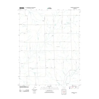
2012 Map of Cambridge NW
USGS Topo · Published 2012About this map
Wingate sits within a landscape defined by a traditional sectional road grid and a network of winding prairie waterways. The drainage pattern is led by Timber Cr, Goose Cr, and Grouse Cr, with the latter being flanked by the Gardners Br in the southeastern portion of the quadrangle. This area of Butler County shows a clear intersection of agricultural settlement and energy extraction, visible in the proximity of family-named cemeteries to industrial operations.
Find a feature on this map
38 named features on this map. Tap any name to fly to it.
Don’t see what you’re looking for? This feature index may not catch every label — zoom into the map to look around manually.
Map Details
Editions of this 2012 Cambridge NW Map
This is the sole edition of this map. No revisions or reprints were ever made.
Other maps of this area
1888 · Eldorado
USGS Topo · 1:125,000
1889 · Burden
USGS Topo · 1:125,000
1955 · Wichita
USGS Topo · 1:250,000
1958 · Wichita
USGS Topo · 1:250,000
1962 · Grand Summit
USGS Topo · 1:24,000
1962 · Cambridge
USGS Topo · 1:24,000
1964 · Augusta SE
USGS Topo · 1:24,000
1964 · Latham
USGS Topo · 1:24,000
1964 · Cambridge NW
USGS Topo · 1:24,000
1964 · Cambridge NE
USGS Topo · 1:24,000