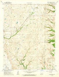
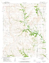
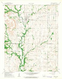
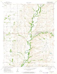
1962 Map of Grand Summit
USGS Topo · Published 1963About this map
The Atchison Topeka and Santa Fe railroad cuts a diagonal line across this landscape, passing through the settlement of Grand Summit. This early 1960s survey captures the cattle-ranching and oil-producing character of the Flint Hills region on the borders of Cowley, Elk, and Chautauqua Counties. Water sources are critical here, with Cedar Creek, Otter Creek, and Spring Creek carving deep drainage patterns into the terrain. Local history and genealogy interest is anchored by Gospel Ridge Cem in the southwestern corner, while the presence of several Oil Fields, Oil Wells, and a Gas Well highlights the energy industry's footprint in the townships of Greenfield, Windsor, and Otter.
Find a feature on this map
19 named features on this map. Tap any name to fly to it.
Don’t see what you’re looking for? This feature index may not catch every label — zoom into the map to look around manually.
Map Details
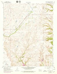
Editions of this 1962 Grand Summit Map
2 editions found
Other maps of this area

1885 · Sedan
USGS Topo · 1:125,000

1889 · Burden
USGS Topo · 1:125,000

1889 · Sedan
USGS Topo · 1:125,000

1955 · Wichita
USGS Topo · 1:250,000

1958 · Wichita
USGS Topo · 1:250,000
1962 · Dexter
USGS Topo · 1:24,000
1962 · Cloverdale
USGS Topo · 1:24,000
1962 · Dexter NE
USGS Topo · 1:24,000
1962 · Grenola
USGS Topo · 1:24,000
1962 · Cambridge
USGS Topo · 1:24,000