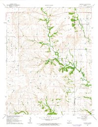
1962 Map of Dexter NE
USGS Topo · Published 1963About this map
Boone Ranch and several other family-named ranching sites anchor the landscape of southeastern Kansas in the early 1960s. This survey of the Flint Hills region captures the rural agricultural structure of Dexter and Otter townships, where land use was defined by drainage basins and elevated topography. The prominent Hogback Hill overlooks the winding course of Otter Creek, while a small Cem remains as a local landmark near the Mills Ranch. The map reveals a network of watercourses including Shafer Creek and Crabb Creek that dictated early settlement patterns. Straddling the boundary of Cowley County and Chautauqua County, the area is characterized by scattered homesteads like the McCoy Ranch and Folsom Ranch, reflecting the enduring ranching heritage of the plains before modern agricultural consolidation.
Find a feature on this map
20 named features on this map. Tap any name to fly to it.
Don’t see what you’re looking for? This feature index may not catch every label — zoom into the map to look around manually.
Map Details
Editions of this 1962 Dexter NE Map
2 editions found
Other maps of this area

1885 · Sedan
USGS Topo · 1:125,000

1889 · Burden
USGS Topo · 1:125,000

1889 · Sedan
USGS Topo · 1:125,000

1955 · Wichita
USGS Topo · 1:250,000

1958 · Wichita
USGS Topo · 1:250,000
1962 · Cedar Vale West
USGS Topo · 1:24,000

1962 · Dexter SW
USGS Topo · 1:24,000

1962 · Grand Summit
USGS Topo · 1:24,000

1962 · Dexter
USGS Topo · 1:24,000
1962 · Cedar Vale East
USGS Topo · 1:24,000