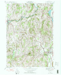
1944 Map of Cambridge
USGS Topo · Published 1964About this map
The Batten Kill river winds through the northern reach of this Washington County landscape, anchoring early industrial sites like Battenville and Center Falls. This mid-century survey reveals a rural network of small agricultural hamlets and school districts, including School No 1, School No 2, and the Covy Sch. The village of Cambridge serves as a local hub near the Woodlawn Cem, with the Delaware and Hudson railroad corridor tracking the eastern valley floor.
Find a feature on this map
35 named features on this map. Tap any name to fly to it.
Don’t see what you’re looking for? This feature index may not catch every label — zoom into the map to look around manually.
Map Details
Editions of this 1944 Cambridge Map
3 editions found
Other maps of this area

1893 · Cohoes
USGS Topo · 1:62,500

1895 · Cohoes
USGS Topo · 1:62,500

1895 · Cambridge
USGS Topo · 1:62,500

1897 · Hoosick
USGS Topo · 1:62,500

1898 · Cambridge
USGS Topo · 1:62,500

1898 · Cohoes
USGS Topo · 1:62,500

1900 · Taconic
USGS Topo · 1:125,000

1900 · Schuylerville
USGS Topo · 1:62,500

1901 · Cambridge
USGS Topo · 1:62,500

1903 · Mettawee
USGS Topo · 1:125,000