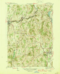
1946 Map of Cambridge
USGS Topo · Published 1946About this map
The Batten Kill river valley anchors this mid-century portrait of Washington County, where the Greenwich and Johnsonville railroad corridor links the industrial and agricultural centers of Greenwich and Cambridge. This era of the landscape is defined by its rural infrastructure, featuring a network of local schools like the Cary Sch, School No 1, and School No 2 that served the scattered hamlets of Center Falls, Battenville, and Coila. The terrain is marked by prominent elevations such as Mt Colfax and The Cobble, which overlook a series of small water bodies including Hedges Lake, Lake Lauderdale, and Dead Lake to the east. The map also documents significant community landmarks of the period, notably the Mary McClellan Hospital and Woodland Cem on the outskirts of Cambridge, providing a clear record of the area's development before post-war modernization significantly altered these traditional New York townships.
Find a feature on this map
37 named features on this map. Tap any name to fly to it.
Don’t see what you’re looking for? This feature index may not catch every label — zoom into the map to look around manually.
Map Details
Editions of this 1946 Cambridge Map
2 editions found
Other maps of this area

1893 · Cohoes
USGS Topo · 1:62,500

1895 · Cohoes
USGS Topo · 1:62,500

1895 · Cambridge
USGS Topo · 1:62,500

1897 · Hoosick
USGS Topo · 1:62,500

1898 · Cambridge
USGS Topo · 1:62,500

1898 · Cohoes
USGS Topo · 1:62,500

1900 · Taconic
USGS Topo · 1:125,000

1900 · Schuylerville
USGS Topo · 1:62,500

1901 · Cambridge
USGS Topo · 1:62,500

1903 · Mettawee
USGS Topo · 1:125,000