
1942 Map of Camden
USGS Topo · Published 1942About this map
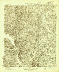
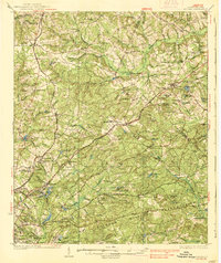
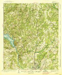
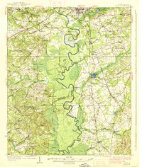
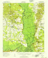
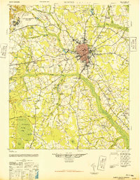
The Wateree River valley serves as the central artery for this mid-century survey, illustrating a landscape defined by the convergence of rail, river, and early highway travel. The Jefferson Davis Highway and major lines like the Southern Railway and Seaboard Railway connect established settlements such as Ridgeway and Blythewood. The map reveals a high density of water-powered infrastructure, including Boykin Mill and Dinkins Mill, alongside local community landmarks like Friends Neck Ch and Du Bose Park Sch.
Find a feature on this map
84 named features on this map. Tap any name to fly to it.
Don’t see what you’re looking for? This feature index may not catch every label — zoom into the map to look around manually.
Map Details
Editions of this 1942 Camden Map
This is the sole edition of this map. No revisions or reprints were ever made.
Other maps of this area

1904 · Columbia
USGS Topo · 1:125,000
1935 · Camden
USGS Topo · 1:48,000

1935 · Killian
USGS Topo · 1:48,000
1937 · Killian
USGS Topo · 1:62,500
1938 · Camden
USGS Topo · 1:62,500
1938 · Hagood
USGS Topo · 1:62,500

1941 · Spartanburg
USGS Topo · 1:250,000
1943 · Eastover
USGS Topo · 1:62,500

1944 · Edmund
USGS Topo · 1:62,500
1946 · Sumter
USGS Topo · 1:62,500