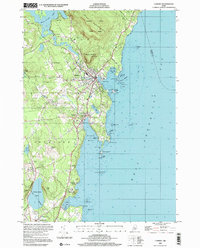
2000 Map of Camden
USGS Topo · Published 2001About this map
The Midcoast Maine shoreline defined by West Penobscot Bay meets the steep elevations of the Camden Hills in this detailed topography. The area's transition from a maritime economy to a residential and recreational hub is visible in the network of streets like Washington St and Chestnut St that fan out from Camden and Rockport. Coastal navigation is meticulously documented, with soundings and hazards such as Lowell Rock and Porterfield Ledge marked near the entrance to Rockport Harbor.
Find a feature on this map
66 named features on this map. Tap any name to fly to it.
Don’t see what you’re looking for? This feature index may not catch every label — zoom into the map to look around manually.
Map Details
Editions of this 2000 Camden Map
This is the sole edition of this map. No revisions or reprints were ever made.
Other maps of this area

1902 · Castine
USGS Topo · 1:62,500

1904 · Castine
USGS Topo · 1:62,500

1904 · Vinalhaven
USGS Topo · 1:62,500

1904 · Rockland
USGS Topo · 1:62,500

1905 · Penobscot Bay
USGS Topo · 1:125,000

1906 · Rockland
USGS Topo · 1:62,500

1915 · Belfast
USGS Topo · 1:62,500

1917 · Belfast
USGS Topo · 1:62,500

1941 · Belfast
USGS Topo · 1:62,500

1941 · Rockland
USGS Topo · 1:62,500