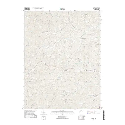
2016 Map of Camden
USGS Topo · Published 2016About this map
Churchville and Freemansburg anchor the northern reaches of this Lewis County landscape, where the terrain is deeply carved by the Left Fork Freemans Cr and Isaacs Fork. The central corridor follows the path of Leading Cr toward the settlement of Camden, a point of convergence near Mt Hall Spring. To the east, the area around Pricetown and Waldeck transitions into a network of small reservoirs, including Wolfpen Lake and Keith Fork Lake, which support the local watershed.
Find a feature on this map
97 named features on this map. Tap any name to fly to it.
Don’t see what you’re looking for? This feature index may not catch every label — zoom into the map to look around manually.
Map Details
Editions of this 2016 Camden Map
This is the sole edition of this map. No revisions or reprints were ever made.
Other maps of this area

1893 · Buckhannon
USGS Topo · 1:125,000

1893 · Sutton
USGS Topo · 1:125,000

1896 · Buckhannon
USGS Topo · 1:125,000

1897 · Buckhannon
USGS Topo · 1:125,000

1904 · Weston
USGS Topo · 1:62,500

1904 · Vadis
USGS Topo · 1:62,500

1906 · Burnsville
USGS Topo · 1:62,500

1912 · Crawford
USGS Topo · 1:48,000

1914 · Crawford
USGS Topo · 1:62,500

1925 · Burnsville
USGS Topo · 1:62,500