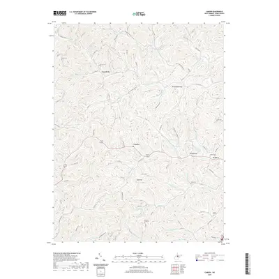
2019 Map of Camden
USGS Topo · Published 2019About this map
Camden and the surrounding Lewis County settlements of Pricetown and Waldeck are defined by a network of steep-walled valleys and narrow ridges. This 2019 survey captures the modern landscape of north-central West Virginia, where the terrain dictates a pattern of winding roads and hillside cemeteries. Family and community heritage is preserved in sites like Woofter Cem, Fisher Cem, and the Harrison Grove Cem near Lake-Riley.
Find a feature on this map
101 named features on this map. Tap any name to fly to it.
Don’t see what you’re looking for? This feature index may not catch every label — zoom into the map to look around manually.
Map Details
Editions of this 2019 Camden Map
This is the sole edition of this map. No revisions or reprints were ever made.
Other maps of this area

1893 · Buckhannon
USGS Topo · 1:125,000

1893 · Sutton
USGS Topo · 1:125,000

1896 · Buckhannon
USGS Topo · 1:125,000

1897 · Buckhannon
USGS Topo · 1:125,000

1904 · Weston
USGS Topo · 1:62,500

1904 · Vadis
USGS Topo · 1:62,500

1906 · Burnsville
USGS Topo · 1:62,500

1912 · Crawford
USGS Topo · 1:48,000

1914 · Crawford
USGS Topo · 1:62,500

1925 · Burnsville
USGS Topo · 1:62,500