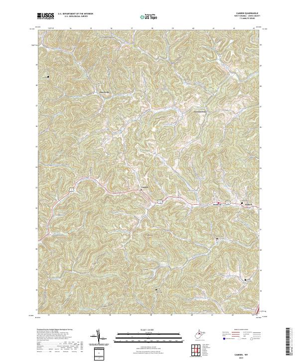
2023 Map of Camden
USGS Topo · Published 2023About this map
Churchville and Freemansburg anchor the northern reaches of this Lewis County landscape, where the terrain is defined by a dense network of branching runs and creeks. The community of Camden sits centrally along the corridor of Polk Creek, while further east, the settlements of Pricetown and Waldeck follow the course of Fink Creek. This area of West Virginia is characterized by its numerous small-scale water bodies, including Wolfpen Lake, Dry Fork Lake, and Keith Fork Lake, which serve as local focal points within the intricate topography. Genealogists will find significant value in the distribution of family-named burial sites, such as Woofter Cem, Fisher Cem, and Harrison Grove Cem, which are scattered throughout the hills. The map also highlights prominent landforms like Sugarloaf and identifies numerous rural thoroughfares such as Isaacs Fork Rd and Raceway Dr, illustrating the persistent connection between these isolated settlements and the surrounding countryside.
Find a feature on this map
95 named features on this map. Tap any name to fly to it.
Don’t see what you’re looking for? This feature index may not catch every label — zoom into the map to look around manually.
Map Details
Editions of this 2023 Camden Map
This is the sole edition of this map. No revisions or reprints were ever made.
Other maps of this area

1893 · Buckhannon
USGS Topo · 1:125,000

1893 · Sutton
USGS Topo · 1:125,000

1896 · Buckhannon
USGS Topo · 1:125,000

1897 · Buckhannon
USGS Topo · 1:125,000

1904 · Weston
USGS Topo · 1:62,500

1904 · Vadis
USGS Topo · 1:62,500

1906 · Burnsville
USGS Topo · 1:62,500

1912 · Crawford
USGS Topo · 1:48,000

1914 · Crawford
USGS Topo · 1:62,500

1925 · Burnsville
USGS Topo · 1:62,500