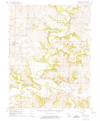
1961 Map of Camden Point
USGS Topo · Published 1975About this map
The Platte River and Little Platte River carve a meandering path through this portion of Platte County, defining the landscape’s drainage and agricultural patterns. The presence of an Old Railroad Grade and the junction at Edgerton Junction point to an era of changing transportation networks, where rail lines once connected small agrarian hubs like Ridgely and Camden Point. These small communities are punctuated by a dense network of family and community burial grounds, including McComas Cem, Cockrell Cem, and Mt Zion Cem, which provide significant anchor points for genealogical research.
Find a feature on this map
40 named features on this map. Tap any name to fly to it.
Don’t see what you’re looking for? This feature index may not catch every label — zoom into the map to look around manually.
Map Details
Editions of this 1961 Camden Point Map
2 editions found
Other maps of this area

1890 · Kansas City
USGS Topo · 1:125,000

1894 · Kansas City
USGS Topo · 1:125,000

1910 · Leavenworth
USGS Topo · 1:62,500

1914 · Smithville
USGS Topo · 1:62,500

1925 · Gower
USGS Topo · 1:62,500

1927 · Dearborn
USGS Topo · 1:62,500
1948 · Nashua
USGS Topo · 1:24,000

1948 · Leavenworth
USGS Topo · 1:62,500

1950 · Kansas City
USGS Topo · 1:250,000
1950 · Nashua
USGS Topo · 1:24,000