
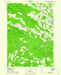
1943 Map of Camden West
USGS Topo · Published 1943About this map
The New York Central railroad corridor anchors the eastern edge of this landscape, connecting the village of Camden to the broader regional economy during the Second World War. This territory, mapped by the Tennessee Valley Authority for the War Department, reveals a rural fabric defined by family-named crossroads and numbered schoolhouses. Deeply wooded areas like Camden Woods transition into a network of small farmsteads linked by namesake routes such as Brockway Road and Hillsboro Road.
Find a feature on this map
43 named features on this map. Tap any name to fly to it.
Don’t see what you’re looking for? This feature index may not catch every label — zoom into the map to look around manually.
Map Details
Editions of this 1943 Camden West Map
2 editions found
Other maps of this area

1895 · Chittenango
USGS Topo · 1:62,500

1895 · Oneida
USGS Topo · 1:62,500

1898 · Oneida
USGS Topo · 1:62,500

1898 · Chittenango
USGS Topo · 1:62,500

1902 · Chittenango
USGS Topo · 1:62,500

1902 · Oneida
USGS Topo · 1:62,500

1905 · Taberg
USGS Topo · 1:62,500

1906 · Kasoag
USGS Topo · 1:62,500

1939 · Oneida
USGS Topo · 1:62,500

1941 · Cleveland
USGS Topo · 1:24,000