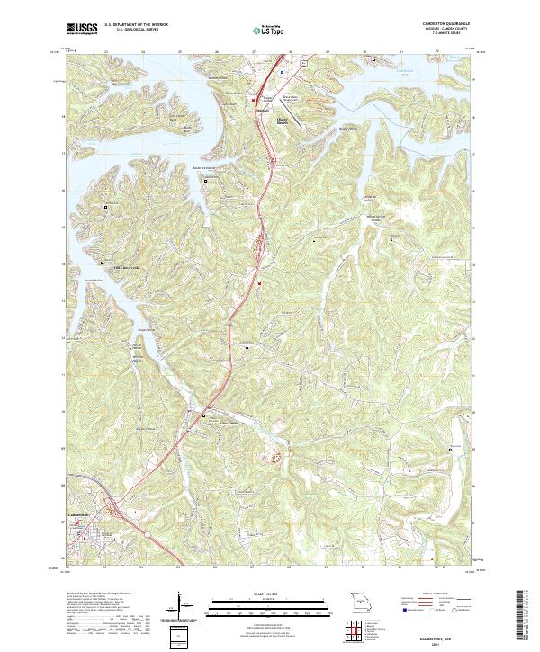
2021 Map of Camdenton
USGS Topo · Published 2021About this map
Linn Creek and the surrounding Camden County hillsides define this landscape, where the deeply indented shoreline of the Lake of the Ozarks meets a complex network of ridges and hollows. The area's history of displacement and relocation is visible in the placement of Old Linn Creek along the water's edge and the newer community of Camdenton to the south, which serves as the county seat. Numerous family and community burial grounds, such as Zion Cem, Williams Cem, and the Old Erie Cem, are scattered across the terrain, reflecting the long-established settlement patterns of the Ozark Plateau.
Find a feature on this map
171 named features on this map. Tap any name to fly to it.
Don’t see what you’re looking for? This feature index may not catch every label — zoom into the map to look around manually.
Map Details
Editions of this 2021 Camdenton Map
This is the sole edition of this map. No revisions or reprints were ever made.
Historical Maps of Damsel Through Time
4 maps found