
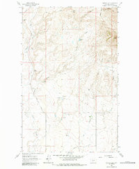
1962 Map of Cameron Lake
USGS Topo · Published 1964About this map
Gold Butte and Jackass Butte define the topography of this Montana landscape in the early 1960s, where the high plains are carved by an intricate network of coulees and gulches. The area shows a sparse but established ranching footprint, with family-named homesteads including the Old Barnaby Ranch, Wood Ranch, and Eide Ranch scattered across the drainages.
Find a feature on this map
22 named features on this map. Tap any name to fly to it.
Don’t see what you’re looking for? This feature index may not catch every label — zoom into the map to look around manually.
Map Details
Editions of this 1962 Cameron Lake Map
2 editions found
Other maps of this area

1943 · Antelope Coulee
USGS Topo · 1:62,500

1945 · West Butte
USGS Topo · 1:62,500

1954 · Shelby
USGS Topo · 1:250,000

1958 · Shelby
USGS Topo · 1:250,000

1962 · Whitlash
USGS Topo · 1:24,000

1962 · Hawthorne School
USGS Topo · 1:24,000

1962 · Berkholder Reservoir
USGS Topo · 1:24,000

1962 · Fey Lakes
USGS Topo · 1:24,000

1962 · Grassy Butte
USGS Topo · 1:24,000

1984 · Sweet Grass Hills
USGS Topo · 1:100,000