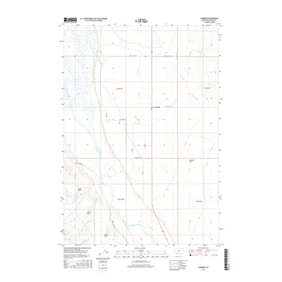
2017 Map of Cameron
USGS Topo · Published 2017About this map
The Madison River flows through this Madison County landscape, defining a wide valley characterized by an intricate system of agricultural water management. The small settlement of Cameron serves as a local hub, featuring a Po and access to the Bear Creek Loop. The surrounding geography is marked by the prominent Cameron Bench and several western drainages including Morgan Gulch and Sunrise Gulch. This 2017 survey reveals the importance of irrigation to the local ranching economy, with numerous man-made channels like Burger Ditch, Indian Cr Ditch, and Granger Ditch crisscrossing the flats. These ditches pull water from natural tributaries such as Bear Cr and Mill Cr to sustain the valley floor, while infrastructure like the Holding Pen near Bowman road underscores the area's continued use for livestock production.
Find a feature on this map
67 named features on this map. Tap any name to fly to it.
Don’t see what you’re looking for? This feature index may not catch every label — zoom into the map to look around manually.
Map Details
Editions of this 2017 Cameron Map
This is the sole edition of this map. No revisions or reprints were ever made.
Other maps of this area

1888 · Three Forks
USGS Topo · 1:250,000

1894 · Three Forks
USGS Topo · 1:250,000

1895 · Three Forks
USGS Topo · 1:250,000

1947 · Bozeman
USGS Topo · 1:250,000

1948 · Bozeman
USGS Topo · 1:250,000

1949 · Varney
USGS Topo · 1:62,500

1949 · Ennis
USGS Topo · 1:62,500

1950 · Cameron
USGS Topo · 1:62,500

1950 · Virginia City
USGS Topo · 1:62,500

1955 · Bozeman
USGS Topo · 1:250,000