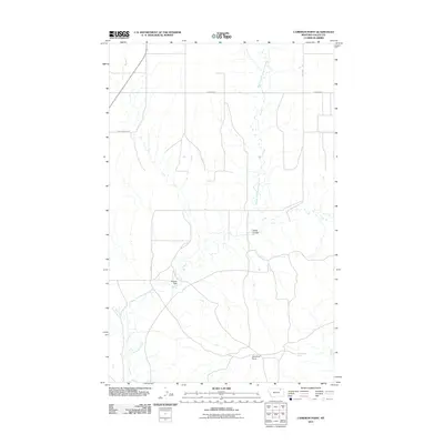
2011 Map of Cameron Point
USGS Topo · Published 2011About this map
Middle Fork Porcupine Creek and its neighboring branches define this high-plains landscape in the Frazer District of Valley County. In this early twenty-first-century view, the terrain is shaped by water drainage patterns through features like Snow Coulee and the landmark high ground at Cameron Point. Human influence on the drainage is evident through infrastructure like Midway Dam, while the presence of Calderwood Spring points to the vital importance of water sources in this dry region. The map details a network of rural routes, including Fuhrman Rd and Fauth Rd, which navigate the rises and falls of the creek systems. The junction where West Fork Porcupine Creek meets the main stem of Porcupine Creek anchors the southwestern portion of the quadrangle, illustrating the natural watershed that has historically dictated land use and travel in this part of Montana.
Find a feature on this map
11 named features on this map. Tap any name to fly to it.
Don’t see what you’re looking for? This feature index may not catch every label — zoom into the map to look around manually.
Map Details
Editions of this 2011 Cameron Point Map
This is the sole edition of this map. No revisions or reprints were ever made.
Other maps of this area

1918 · Porcupine Valley
USGS Topo · 1:62,500

1919 · Boundary
USGS Topo · 1:125,000

1943 · Glasgow
USGS Topo · 1:125,000

1954 · Glasgow
USGS Topo · 1:250,000

1957 · Glasgow
USGS Topo · 1:250,000

1958 · Glasgow
USGS Topo · 1:250,000

1969 · Chapman Coulee NE
USGS Topo · 1:24,000

1973 · Baylor SE
USGS Topo · 1:24,000

1973 · Baylor NE
USGS Topo · 1:24,000

1973 · Baylor
USGS Topo · 1:24,000