
1969 Map of Chapman Coulee NE
USGS Topo · Published 1972About this map
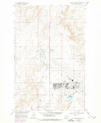
Glasgow Air Force Base dominates the landscape of Valley County in this late 1960s survey, revealing a high-density footprint of military infrastructure amidst the surrounding drainage basins. The base complex includes a significant residential and civic layout, featuring the Westside Sch, North Star, and Jr High Sch, alongside essential facilities like a Hospital and Fire Sta. The area's logistical importance is further underscored by the Burlington Northern railroad line and an extensive Aqueduct system.
Find a feature on this map
26 named features on this map. Tap any name to fly to it.
Don’t see what you’re looking for? This feature index may not catch every label — zoom into the map to look around manually.
Map Details
Editions of this 1969 Chapman Coulee NE Map
2 editions found
Other maps of this area

1918 · Porcupine Valley
USGS Topo · 1:62,500

1919 · Boundary
USGS Topo · 1:125,000

1943 · Glasgow
USGS Topo · 1:125,000

1954 · Glasgow
USGS Topo · 1:250,000

1957 · Glasgow
USGS Topo · 1:250,000

1958 · Glasgow
USGS Topo · 1:250,000

1969 · Cornwell Reservoir
USGS Topo · 1:24,000
1969 · Chapman Coulee
USGS Topo · 1:24,000

1969 · Hawk Coulee
USGS Topo · 1:24,000

1973 · Cameron Point
USGS Topo · 1:24,000