
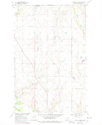
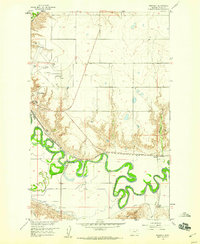
1969 Map of Chapman Coulee
USGS Topo · Published 1972About this map
The Milk River flows through the southern reach of this Valley County landscape, anchoring a complex system of drainage channels that define the local topography. This 1969 field-checked survey reveals an environment shaped by water management and resource extraction, notably centered around the Cornwell Reservoir in the north and several Gravel Pits located near the main coulee. The land is intricately carved by numerous seasonal watercourses, including Chapman Coulee, Mooney Coulee, and Richardson Coulee, which all direct runoff toward the river valley. The infrastructure of the era is represented by a persistent pipeline network and a system of improved and unimproved roads that trace the section lines. Smaller drainages like Cherry Creek and Alkali Coulee illustrate the high-relief character of the Missouri River Basin development area during the late 1960s.
Find a feature on this map
12 named features on this map. Tap any name to fly to it.
Don’t see what you’re looking for? This feature index may not catch every label — zoom into the map to look around manually.
Map Details
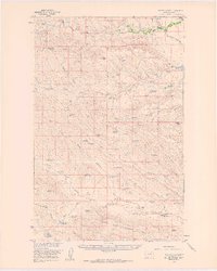
Editions of this 1969 Chapman Coulee Map
2 editions found
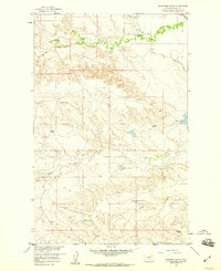
Other maps of this area

1943 · Glasgow
USGS Topo · 1:125,000

1954 · Glasgow
USGS Topo · 1:250,000

1957 · Glasgow
USGS Topo · 1:250,000

1958 · Glasgow
USGS Topo · 1:250,000
1958 · Engstrom Ranch
USGS Topo · 1:24,000
1958 · Miller Coulee
USGS Topo · 1:62,500
1958 · Glasgow
USGS Topo · 1:24,000
1958 · Whately
USGS Topo · 1:24,000
1969 · Cornwell Reservoir
USGS Topo · 1:24,000
1969 · Chapman Coulee NE
USGS Topo · 1:24,000