
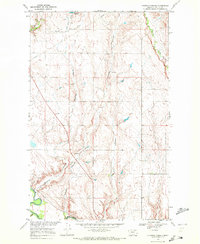
1958 Map of Engstrom Ranch
USGS Topo · Published 1960About this map
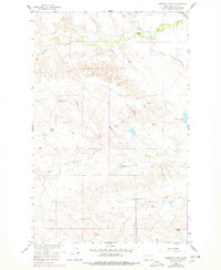
Isolated homesteads like the Billingsley Ranch and Uphaus Ranch define the settlement pattern of this Valley County landscape during the late 1950s. The terrain is deeply shaped by the seasonal hydrology of the Missouri River Basin, characterized by the winding paths of Antelope Creek and Brazil Creek. A sophisticated network of man-made water management is evident through numerous stock ponds and reservoirs, including Reservoir No 28 and the Mahan and Hoyt Res, essential for sustaining livestock in this arid environment. The presence of the Vandalia South Canal and a Road on Levee highlights the infrastructure required for regional irrigation and flood control. Near the southern boundary, the Engstrom Ranch sits among the draws of Little Brazil Creek, while scattered Gravel Pits suggest localized resource extraction in an area primarily dedicated to cattle ranching.
Find a feature on this map
15 named features on this map. Tap any name to fly to it.
Don’t see what you’re looking for? This feature index may not catch every label — zoom into the map to look around manually.
Map Details
Editions of this 1958 Engstrom Ranch Map
2 editions found
Other maps of this area

1943 · Glasgow
USGS Topo · 1:125,000

1954 · Glasgow
USGS Topo · 1:250,000

1957 · Glasgow
USGS Topo · 1:250,000

1958 · Glasgow
USGS Topo · 1:250,000

1958 · Miller Coulee
USGS Topo · 1:62,500

1958 · Glasgow
USGS Topo · 1:24,000
1958 · Blanchard Ranch
USGS Topo · 1:24,000
1958 · Billick Coulee
USGS Topo · 1:24,000
1969 · Tampico
USGS Topo · 1:24,000
1969 · Chapman Coulee
USGS Topo · 1:24,000