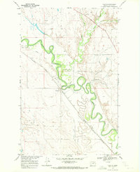
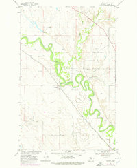
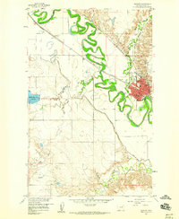
1969 Map of Tampico
USGS Topo · Published 1972About this map
The Milk River defines this portion of Valley County, winding through the valley floor in tight oxbows and loops. Near the settlement of Tampico, the Burlington Northern railroad corridor and the Vandalia South Canal parallel the river's path, highlighting the importance of water management and transit in this semi-arid landscape. The map captures an era of post-war agricultural infrastructure, with the Landing Strip and various water control features like Cain Dam supporting local operations.
Find a feature on this map
17 named features on this map. Tap any name to fly to it.
Don’t see what you’re looking for? This feature index may not catch every label — zoom into the map to look around manually.
Map Details
Editions of this 1969 Tampico Map
2 editions found
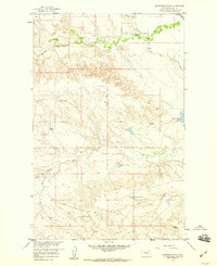
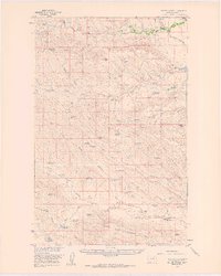
Other maps of this area

1943 · Glasgow
USGS Topo · 1:125,000

1954 · Glasgow
USGS Topo · 1:250,000

1957 · Glasgow
USGS Topo · 1:250,000

1958 · Glasgow
USGS Topo · 1:250,000
1958 · Engstrom Ranch
USGS Topo · 1:24,000
1958 · Miller Coulee
USGS Topo · 1:62,500
1958 · Glasgow
USGS Topo · 1:24,000
1958 · Billick Coulee
USGS Topo · 1:24,000
1969 · Cornwell Reservoir
USGS Topo · 1:24,000

1969 · Chapman Coulee
USGS Topo · 1:24,000