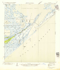
1954 Map of Caminada Pass
USGS Topo · Published 1954About this map
Cheniere Caminada and the western tip of Grand Isle dominate this mid-century coastal survey, reflecting a landscape defined by an intricate network of marshes and water bodies. The transition from the open Gulf of Mexico to the sheltered Caminada Bay is mediated by Caminada Pass, a vital maritime opening. The map captures a specialized coastal topography where narrow strips of habitable land are crisscrossed by a State Highway that serves as a lifeline for these barrier communities. Inland, the terrain dissolves into a complex system of bayous and lakes, such as Bayou Fort Blanc, Bayou Ferblanc, and Lake Palourde. This survey, compiled from aerial photographs and land records from the General Land Office, provides a precise look at the parish boundary between Lafourche Parish and Jefferson Parish during an era of significant coastal change.
Find a feature on this map
21 named features on this map. Tap any name to fly to it.
Don’t see what you’re looking for? This feature index may not catch every label — zoom into the map to look around manually.
Map Details
Editions of this 1954 Caminada Pass Map
This is the sole edition of this map. No revisions or reprints were ever made.
Other maps of this area

1892 · Cheniere Caminada
USGS Topo · 1:62,500

1892 · Creole
USGS Topo · 1:62,500

1893 · Fort Livingston
USGS Topo · 1:62,500

1935 · Mink Bayou
USGS Topo · 1:31,680

1935 · Leeville
USGS Topo · 1:31,680

1945 · New Orleans
USGS Topo · 1:250,000

1945 · Leeville
USGS Topo · 1:31,680
1946 · Mink Bayou
USGS Topo · 1:31,680

1947 · Caminada Pass
USGS Topo · 1:31,680
1948 · Fort Livingston
USGS Topo · 1:62,500