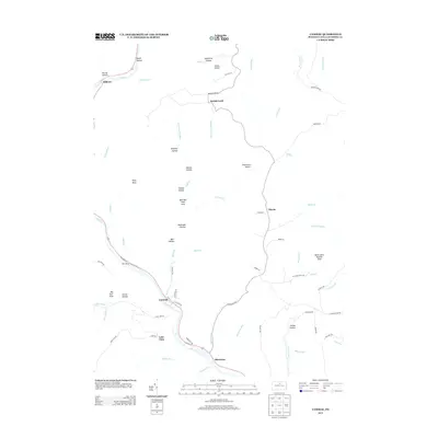
2013 Map of Cammal
USGS Topo · Published 2013About this map
Cammal anchors the sharp bend of Pine Creek in this northern Lycoming County landscape, where deep-cut valleys and steep hollows define the settlement patterns. The map highlights the area's recreational and conservation character, notably through the Wolf Run Wild Area and the Bark Cabin Natural Area. Small communities such as Beulah Land and Okome are connected by a network of high-elevation roads like Tower Rd and Old Post Office Rd, reflecting the region's history of upland habitation and early infrastructure. Numerous named geographic features, including Wolf Rock and Big Trail Vista, point toward a long-standing tradition of forest management and outdoor navigation. The drainage network is particularly dense, with names like Spook Hollow, Silver Springs, and Bark Cabin Run illustrating the intricate hydrology that has shaped the local topography and human access for generations.
Find a feature on this map
80 named features on this map. Tap any name to fly to it.
Don’t see what you’re looking for? This feature index may not catch every label — zoom into the map to look around manually.
Map Details
Editions of this 2013 Cammal Map
This is the sole edition of this map. No revisions or reprints were ever made.
Other maps of this area

1935 · Waterville
USGS Topo · 1:24,000

1937 · Waterville
USGS Topo · 1:48,000

1943 · Hyner
USGS Topo · 1:62,500

1943 · Waterville
USGS Topo · 1:62,500

1946 · Antrim
USGS Topo · 1:62,500

1946 · Renovo East
USGS Topo · 1:62,500

1946 · Cedar Run
USGS Topo · 1:24,000

1946 · Slate Run
USGS Topo · 1:24,000

1946 · Glen Union
USGS Topo · 1:24,000

1946 · Morris
USGS Topo · 1:24,000
Featured Places
- Lebo Vista, McHenry Township
- Hilborn, Brown Township
- Brown Township, PA
- Beulah Land, Brown Township
- McHenry Township, PA