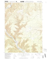
1994 Map of Cammal
USGS Topo · Published 1999About this map
Cammal serves as a focal point along the winding Pine Creek, where the Penn Central rail line follows the narrow valley floor. The settlement pattern here is dictated by the dramatic topography of the Tiadaghton State Forest, with small clusters like Ross Siding and Bluestone hugging the river banks. Higher elevations reveal a different character of land use, including the Barrens and the remote Beulah Land clearing.
Find a feature on this map
67 named features on this map. Tap any name to fly to it.
Don’t see what you’re looking for? This feature index may not catch every label — zoom into the map to look around manually.
Map Details
Editions of this 1994 Cammal Map
This is the sole edition of this map. No revisions or reprints were ever made.
Other maps of this area

1935 · Waterville
USGS Topo · 1:24,000

1937 · Waterville
USGS Topo · 1:48,000

1943 · Hyner
USGS Topo · 1:62,500

1943 · Waterville
USGS Topo · 1:62,500

1946 · Antrim
USGS Topo · 1:62,500

1946 · Renovo East
USGS Topo · 1:62,500

1946 · Cedar Run
USGS Topo · 1:24,000

1946 · Slate Run
USGS Topo · 1:24,000

1946 · Glen Union
USGS Topo · 1:24,000

1946 · Morris
USGS Topo · 1:24,000
Featured Places
- Brown Township, PA
- Lebo Vista, McHenry Township
- Bluestone, McHenry Township
- Hilborn, Brown Township
- McHenry Township, PA