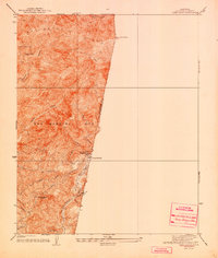
1940 Map of Camp Baldy
USGS Topo · Published 1940About this map
San Antonio Peak and the high ridges of the San Gabriel Mts dominate this 1934 topographic survey, which captures the area before mid-century development altered the canyon landscape. The settlement at Camp Baldy serves as a central point for mountain access, supported by the Camp Baldy Guard Station and a network of fire management infrastructure, including several named Firebreak lines cut across the steep slopes.
Find a feature on this map
23 named features on this map. Tap any name to fly to it.
Don’t see what you’re looking for? This feature index may not catch every label — zoom into the map to look around manually.
Map Details
Editions of this 1940 Camp Baldy Map
3 editions found
Other maps of this area

1897 · Cucamonga
USGS Topo · 1:62,500

1900 · Cucamonga
USGS Topo · 1:62,500

1901 · Southern California Sheet No. 1
USGS Topo · 1:250,000

1903 · Cucamonga
USGS Topo · 1:62,500

1903 · San Antonio
USGS Topo · 1:62,500

1904 · Southern California Sheet No. 1
USGS Topo · 1:250,000
1928 · La Verne
USGS Topo · 1:24,000
1933 · La Verne and Evey Canyon
USGS Topo · 1:24,000
1934 · Camp Baldy
USGS Topo · 1:24,000
1934 · Camp Bonita
USGS Topo · 1:24,000