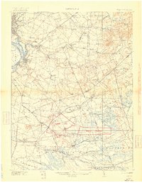
1918 Map of Camp Dix
USGS Topo · Published 1918About this map
Camp Dix and its adjacent Rifle Range dominate the landscape in this wartime survey, established as a major mobilization center during the First World War. The map details the transition from rural agricultural land to a massive military footprint, bounded by a network of historic townships including Mansfield, Springfield, and Pemberton. Significant transport lines like the Pennsylvania RR and the Kinkora Branch serve the region, connecting riverfront hubs like Bordentown and Fieldsboro to the interior settlements.
Find a feature on this map
165 named features on this map. Tap any name to fly to it.
Don’t see what you’re looking for? This feature index may not catch every label — zoom into the map to look around manually.
Map Details
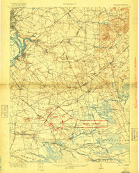
Editions of this 1918 Camp Dix Map
2 editions found
Other maps of this area

1884 · Whitings
USGS Topo · 1:62,500

1888 · Bordentown
USGS Topo · 1:62,500

1888 · Pemberton
USGS Topo · 1:62,500

1888 · New Brunswick
USGS Topo · 1:62,500

1888 · Mount Holly
USGS Topo · 1:62,500

1888 · Princeton
USGS Topo · 1:62,500

1888 · Cassville
USGS Topo · 1:62,500

1888 · Whitings
USGS Topo · 1:62,500

1890 · Lambertville
USGS Topo · 1:62,500

1890 · Burlington
USGS Topo · 1:62,500