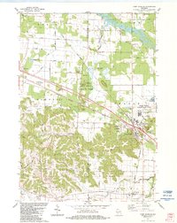
1983 Map of Camp Douglas
USGS Topo · Published 1984About this map
The Lemonweir River and the complex sandstone bluffs of the Driftless Area define this 1980s landscape at the junction of Oakdale, Orange, and Fountain townships. The village of Camp Douglas serves as a critical infrastructure hub, where the Chicago and North Western meets the Chicago Milwaukee St Paul and Pacific railroad lines. This convergence of transport routes is reflected in the heavy military presence nearby, including Volk Field (Air National Guard) and Camp Williams (Army Nat Guard).
Find a feature on this map
55 named features on this map. Tap any name to fly to it.
Don’t see what you’re looking for? This feature index may not catch every label — zoom into the map to look around manually.
Map Details
Editions of this 1983 Camp Douglas Map
This is the sole edition of this map. No revisions or reprints were ever made.
Other maps of this area

1919 · Kendall
USGS Topo · 1:62,500

1921 · Mauston
USGS Topo · 1:62,500

1921 · Kendall
USGS Topo · 1:62,500

1953 · Eau Claire
USGS Topo · 1:250,000

1958 · Eau Claire
USGS Topo · 1:250,000

1958 · Necedah
USGS Topo · 1:48,000

1958 · Wyeville
USGS Topo · 1:48,000

1958 · La Crosse
USGS Topo · 1:250,000

1961 · La Crosse
USGS Topo · 1:250,000

1962 · Kendall
USGS Topo · 1:62,500