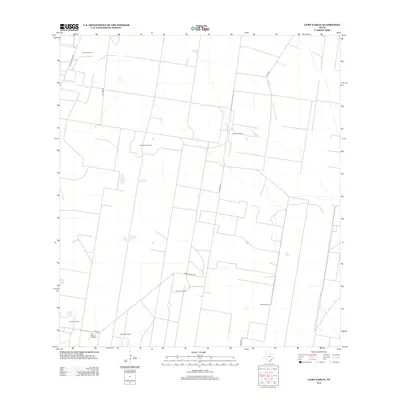
2012 Map of Camp Garcia
USGS Topo · Published 2012About this map
Camp Garcia serves as the namesake for this southern Texas landscape, situated in an area of Hidalgo County defined by its extensive energy infrastructure. The map reveals a lattice of industrial activity, primarily characterized by numerous petroleum extraction sites including the Rincon Oil Field, Davenport Oil Field, and Yturria Oil Field. These fields are connected by a network of specialized routes such as Pipeline Rd and Conoco Plant Rd, highlighting the region's mid-century economic drivers.
Find a feature on this map
15 named features on this map. Tap any name to fly to it.
Don’t see what you’re looking for? This feature index may not catch every label — zoom into the map to look around manually.
Map Details
Editions of this 2012 Camp Garcia Map
This is the sole edition of this map. No revisions or reprints were ever made.
Other maps of this area

1938 · Sal Colorada
USGS Topo · 1:62,500

1939 · La Reforma
USGS Topo · 1:62,500

1940 · Monte Christo
USGS Topo · 1:62,500

1949 · Mc Allen
USGS Topo · 1:250,000

1954 · McAllen
USGS Topo · 1:250,000

1956 · Garcias
USGS Topo · 1:62,500

1957 · Mc Allen
USGS Topo · 1:250,000

1962 · McAllen
USGS Topo · 1:250,000

1963 · Citrus City
USGS Topo · 1:24,000
1963 · McCook
USGS Topo · 1:24,000