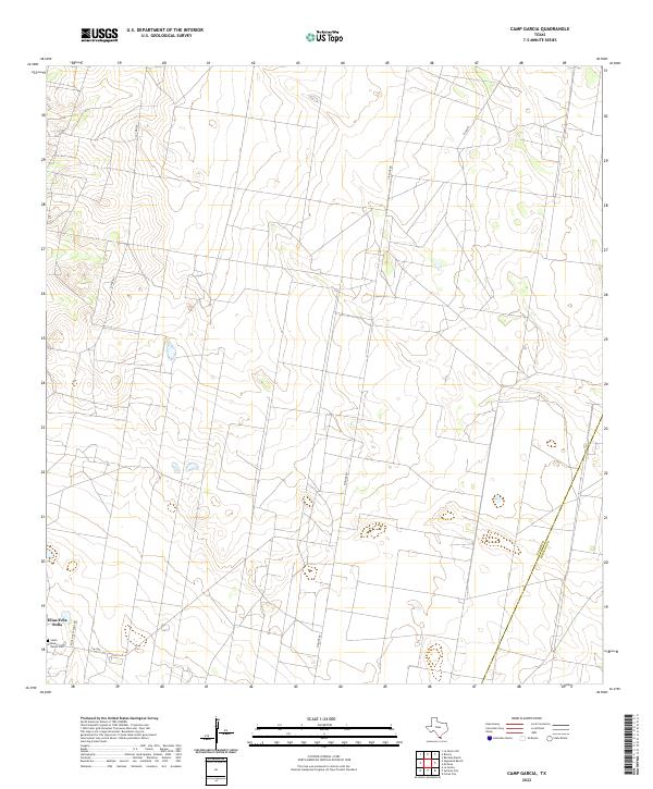
2022 Map of Camp Garcia
USGS Topo · Published 2022About this map
The Elias-Fela Solis settlement area defines this portion of Starr County, characterized by large ranching tracts and agricultural parcels typical of the South Texas brush country. The landscape is marked by long, straight thoroughfares such as Pipeline Rd and El Pañel, which trace the geometric patterns of modern land divisions. Family history is anchored at the Santa Rosa Ranch Cem located near the intersection of Fm 2360 and Elias & Fela Solis Rd. This modern survey documents the subtle relief of the Rio Grande Valley hinterland, where local infrastructure like Las Brisas serves a dispersed population. The map also delineates the eastern political boundary between Starr and Hidalgo counties, illustrating how administrative lines bisect the rural landscape.
Find a feature on this map
8 named features on this map. Tap any name to fly to it.
Don’t see what you’re looking for? This feature index may not catch every label — zoom into the map to look around manually.
Map Details
Editions of this 2022 Camp Garcia Map
This is the sole edition of this map. No revisions or reprints were ever made.
Other maps of this area

1938 · Sal Colorada
USGS Topo · 1:62,500

1939 · La Reforma
USGS Topo · 1:62,500

1940 · Monte Christo
USGS Topo · 1:62,500

1949 · Mc Allen
USGS Topo · 1:250,000

1954 · McAllen
USGS Topo · 1:250,000

1956 · Garcias
USGS Topo · 1:62,500

1957 · Mc Allen
USGS Topo · 1:250,000

1962 · McAllen
USGS Topo · 1:250,000

1963 · Citrus City
USGS Topo · 1:24,000
1963 · McCook
USGS Topo · 1:24,000