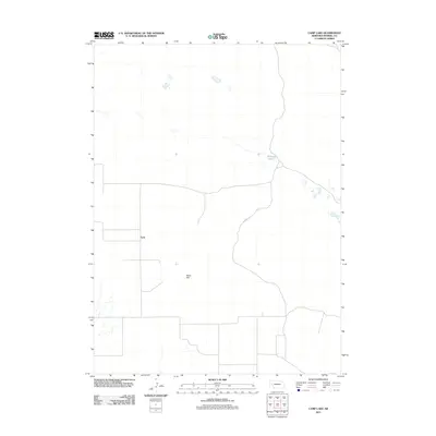
2011 Map of Camp Lake
USGS Topo · Published 2011About this map
The high plains of Morrill County are defined by a sparse network of section roads and isolated water features in this 2011 survey. The settlement of Lynn serves as a primary geographic marker in this corner of the Nebraska panhandle, situated amidst a landscape of subtle elevation changes. Notable topographical landmarks include Reilly Hill, which rises above the surrounding basin, and Peterson Lake, one of the few named bodies of water in the quadrangle. The map documents the rural infrastructure of the early 21st century, showing the established routes such as N Co Rd that connect these remote ranching and agricultural outposts.
Find a feature on this map
4 named features on this map. Tap any name to fly to it.
Don’t see what you’re looking for? This feature index may not catch every label — zoom into the map to look around manually.
Map Details
Editions of this 2011 Camp Lake Map
This is the sole edition of this map. No revisions or reprints were ever made.
Other maps of this area

1896 · Browns Creek
USGS Topo · 1:125,000

1898 · Camp Clarke
USGS Topo · 1:125,000

1899 · Browns Creek
USGS Topo · 1:125,000

1949 · Lynn
USGS Topo · 1:62,500

1954 · Scottsbluff
USGS Topo · 1:250,000

1958 · Scottsbluff
USGS Topo · 1:250,000

1965 · Angora SE
USGS Topo · 1:24,000

1965 · Broadwater NW
USGS Topo · 1:24,000
1965 · Angora NE
USGS Topo · 1:24,000
1965 · Bridgeport
USGS Topo · 1:24,000