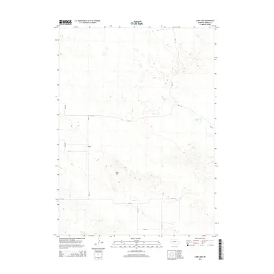
2014 Map of Camp Lake
USGS Topo · Published 2014About this map
Lynn sits at the intersection of several rural routes in Morrill County, serving as a focal point for this expansive agricultural landscape in the early twenty-first century. The terrain is defined by the undulations of the Nebraska Sandhills, most notably at Reilly Hill, which rises above the surrounding plains. This 2014 survey documents a network of section-line roads, including Road 114 and Road 108, that facilitate movement between isolated water features such as Peterson Lake and Camp Lake. These small bodies of water are critical landmarks in a region where the natural drainage patterns are subtle and the land use is primarily dedicated to ranching. The map illustrates how human settlement and infrastructure are sparse but methodically organized around the availability of water and the established grid of the county road system.
Find a feature on this map
12 named features on this map. Tap any name to fly to it.
Don’t see what you’re looking for? This feature index may not catch every label — zoom into the map to look around manually.
Map Details
Editions of this 2014 Camp Lake Map
This is the sole edition of this map. No revisions or reprints were ever made.
Other maps of this area

1896 · Browns Creek
USGS Topo · 1:125,000

1898 · Camp Clarke
USGS Topo · 1:125,000

1899 · Browns Creek
USGS Topo · 1:125,000

1949 · Lynn
USGS Topo · 1:62,500

1954 · Scottsbluff
USGS Topo · 1:250,000

1958 · Scottsbluff
USGS Topo · 1:250,000

1965 · Angora SE
USGS Topo · 1:24,000

1965 · Broadwater NW
USGS Topo · 1:24,000
1965 · Angora NE
USGS Topo · 1:24,000
1965 · Bridgeport
USGS Topo · 1:24,000