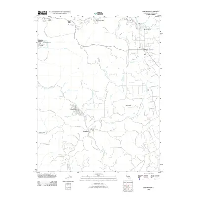
2012 Map of Camp Meeker
USGS Topo · Published 2012About this map
The Russian River winds through the northern reaches of this Sonoma County landscape, anchoring a series of riverside communities including Rio Dell, Mirabel Park, and Summerhome Park. Further south, the terrain transitions into the dense forest and valley topography where Camp Meeker and Occidental serve as central hubs. The map reveals a high concentration of established community infrastructure, particularly cemetery sites such as Forestview Cem, Green Valley Cem, and the uniquely named Druids Occidental Cem.
Find a feature on this map
128 named features on this map. Tap any name to fly to it.
Don’t see what you’re looking for? This feature index may not catch every label — zoom into the map to look around manually.
Map Details
Editions of this 2012 Camp Meeker Map
This is the sole edition of this map. No revisions or reprints were ever made.
Other maps of this area

1920 · Healdsburg
USGS Topo · 1:62,500

1921 · Skaggs
USGS Topo · 1:62,500

1933 · Healdsburg
USGS Topo · 1:48,000

1935 · Sebastopol
USGS Topo · 1:48,000

1940 · Healdsburg
USGS Topo · 1:62,500

1942 · Sebastopol
USGS Topo · 1:62,500

1942 · Bodega Head
USGS Topo · 1:24,000

1943 · Cazadero
USGS Topo · 1:24,000

1943 · Duncans Mills
USGS Topo · 1:24,000

1944 · Bodega Head
USGS Topo · 1:31,680