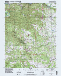
1995 Map of Camp Meeker
USGS Topo · Published 1999About this map
The Russian River wind through the northern reaches of this coastal range landscape, anchoring a series of small riverside communities like Guerneville and Noel Heights. Further south, the settlement of Camp Meeker occupies the narrow valley of Dutch Bill Creek, illustrating the dense, forested development patterns typical of the region. The map highlights a network of local schools that served these dispersed communities, including the Occidental Sch and Jonive Sch, alongside larger educational hubs like El Molino High Sch.
Find a feature on this map
44 named features on this map. Tap any name to fly to it.
Don’t see what you’re looking for? This feature index may not catch every label — zoom into the map to look around manually.
Map Details
Editions of this 1995 Camp Meeker Map
This is the sole edition of this map. No revisions or reprints were ever made.
Other maps of this area

1920 · Healdsburg
USGS Topo · 1:62,500

1921 · Skaggs
USGS Topo · 1:62,500

1933 · Healdsburg
USGS Topo · 1:48,000

1935 · Sebastopol
USGS Topo · 1:48,000

1940 · Healdsburg
USGS Topo · 1:62,500

1942 · Sebastopol
USGS Topo · 1:62,500

1942 · Bodega Head
USGS Topo · 1:24,000

1943 · Cazadero
USGS Topo · 1:24,000

1943 · Duncans Mills
USGS Topo · 1:24,000

1944 · Bodega Head
USGS Topo · 1:31,680