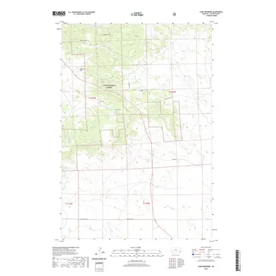
2020 Map of Camp Needmore
USGS Topo · Published 2020About this map
The Ekalaka Hills rise across this landscape in Carter County, Montana, where the rugged terrain is largely protected within the Custer National Forest. The map centers on the small settlement of Camp Needmore, a remote outpost defined by its reliance on a network of vital water sources. Numerous springs, including Shady Spring, Murphy Spring, and the multi-part Oliver Springs, are documented across the hillsides, feeding into drainages like Russell Cr and Little Ramme Cr. Local history is anchored by the Russell Cem, located near the forest boundary, and family-named landmarks such as Carter Gulch and Heggen Draw. The region’s infrastructure is sparse, characterized by long-distance routes like the Pershing Cutoff and Prairiedale Rd, which navigate the elevation changes of this high plains environment.
Find a feature on this map
25 named features on this map. Tap any name to fly to it.
Don’t see what you’re looking for? This feature index may not catch every label — zoom into the map to look around manually.
Map Details
Editions of this 2020 Camp Needmore Map
This is the sole edition of this map. No revisions or reprints were ever made.
Other maps of this area

1954 · Ekalaka
USGS Topo · 1:250,000

1956 · Ekalaka
USGS Topo · 1:250,000

1958 · Ekalaka
USGS Topo · 1:250,000

1965 · Ekalaka
USGS Topo · 1:250,000

1979 · Dead Boy Divide
USGS Topo · 1:24,000

1979 · Ekalaka
USGS Topo · 1:24,000

1980 · Taylor Hills
USGS Topo · 1:24,000

1980 · Belltower
USGS Topo · 1:24,000

1980 · Camp Needmore
USGS Topo · 1:24,000

1980 · Dutchmans Hill
USGS Topo · 1:24,000